Reynisfjara black sand beach
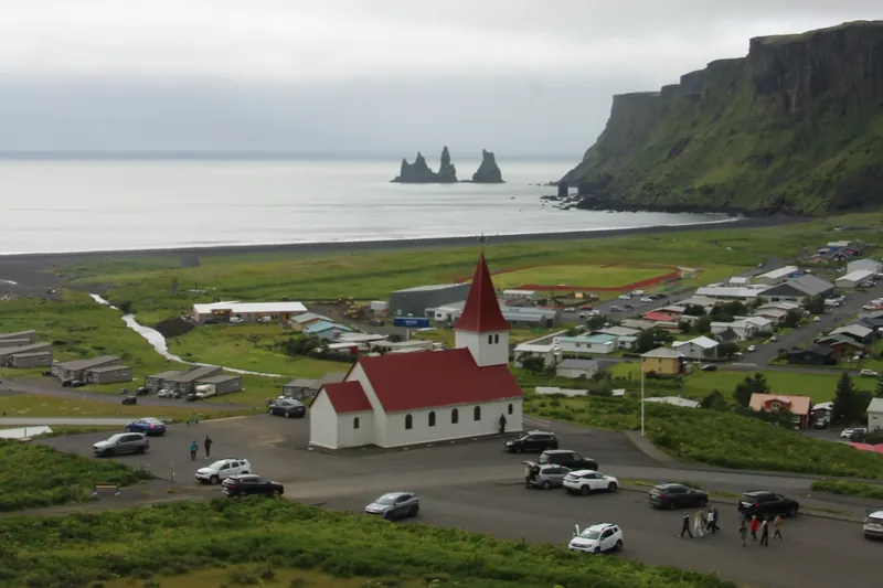
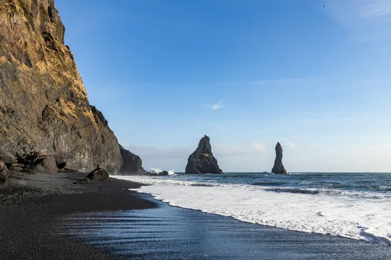
Basalt columns, a cave and sea stacks 66 m high mark Reynisfjara, below the Reynisfjall mountain at Vík. The waves here have killed several visitors. Since 2022 warning signs and a light have marked how far you may go, so check what applies on the day.
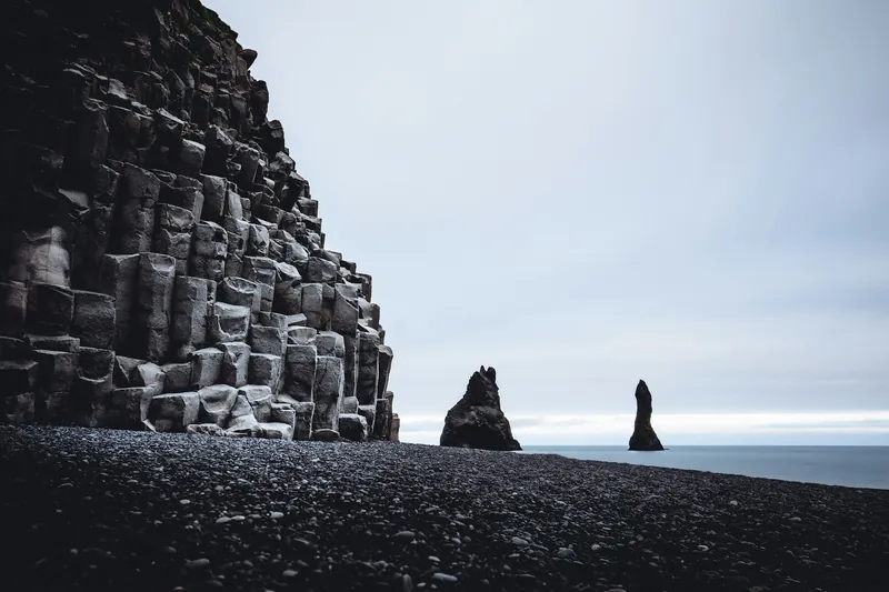
Reynisfjara lies below Reynisfjall, the mountain that rises above the village of Vík. Visit South Iceland describes Reynisfjall as a 340 m tuff mountain formed by an eruption under the ice during the second-to-last glacial period, with layers of columnar basalt, tuff and pillow lava. Out in the sea stand the Reynisdrangar, a group of rock pillars 66 m high that formed in the same way as the mountain.
The beach itself is black sand and pebbles facing the open sea. The water, not the rock, is the reason for the signs and the warning light at its access. Parking has been charged since July 2023 and is paid through the Parka system.
The basalt columns and the cave
Where the mountain meets the beach, the rock shows walls of six-sided basalt columns standing on the sand. Beside them is the cave Hálsanefshellir, which the regional tourist board calls exceedingly beautiful. Both are right at the water's edge, and this is the spot where the risk concentrates: according to a spokesperson for the landowners, the last three fatal accidents on the beach all happened by the basalt columns.
Why the waves are dangerous
Visit South Iceland warns that the waves here are deceptive and have caused the death of a number of visitors in recent years, even in the best of weather. In English they are often called sneaker waves: a single wave runs much further up the sand than the ones before it, without warning.
The landowners count six fatal accidents at Reynisfjara this century, four of them drownings; two were not related to the waves. The first fatal accident involving a tourist was in 2007, and the most recent in August 2025, when the light showed yellow.
How the warning lights work
In December 2022 a consultation group of landowners, the police, the Icelandic Tourist Board, the rescue association ICE-SAR, the Road and Coastal Administration and Katla Geopark completed a new system. It consists of a light signal, three large information boards, six direction signs and a 300 m chain that leads visitors from the car park past the signs. Police cameras on a mast send live images to the police station in Selfoss. The light is linked to an automatic wave forecast run by the Road and Coastal Administration.
According to the landowners, the light shows green when the danger is low, yellow for moderate danger and red for high risk. The beach is never closed as a whole. It is divided into zones by level of danger instead. When the light is yellow you must not enter the yellow zone, and when it is red you must not enter the red zone or go past the light sign. From the beach crest, the raised bank behind the sand, you can watch the waves safely in any conditions. There is no safety staff on site.
After the accident in 2025 the rules were tightened. The danger index was recalibrated using sea level, beach width and the way waves hit the basalt columns, so the red light comes on earlier than before. With a red light, access from the viewing platform on the beach crest is shut, and walking to the basalt columns or into Hálsanefshellir is forbidden. A closure gate for red-light days was due to be installed within days, and in September 2025 a barrier stood across the path while the light was red. The landowners, the Tourist Board, the South Iceland Police, Safetravel and the local rescue team Víkverji also set up a safety group that meets regularly.
The erosion of February 2026
In February 2026 heavy seas eroded the beach. At high tide on Sunday 22 February the ground beneath the viewing platform and two of the safety signs washed away. The sign with the zone map collapsed, and the illuminated warning sign was removed because its foundations had been undermined. The Icelandic Tourist Board then reported that visitors could go only as far as the upper beach ridge, with no way down to the basalt columns, while the car park, the restaurant and the toilets stayed open. The landowners announced new safety signs and a rebuilt viewing platform. We found no later official notice about the new signs, so check what is in place when you arrive and follow it.
Kirkjufjara and the view west
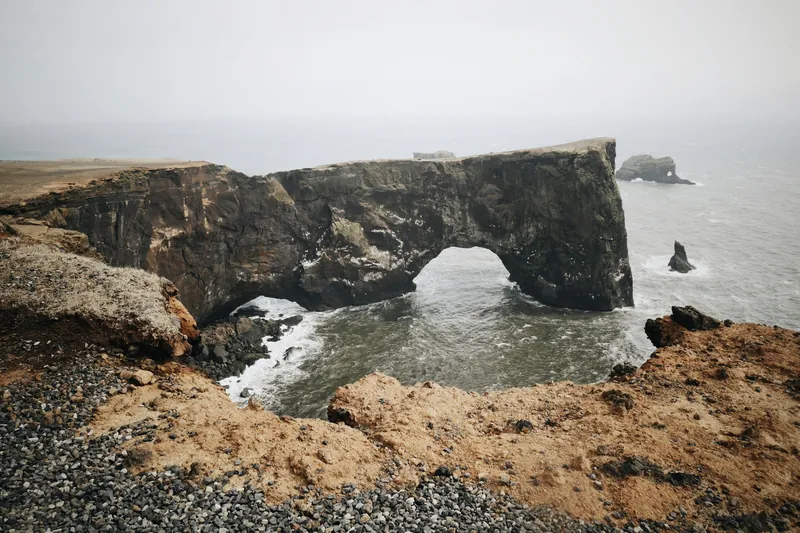
West of Reynisfjara the coast continues towards the Dyrhólaey headland. The smaller beach below it, Kirkjufjara, has been closed to visitors after rock falls and accidents at sea between 2012 and 2017, according to the Environment Agency. The headland above is open, with seasonal limits in the nesting season, and is described on our Dyrhólaey page.
Seeing the beach from above or on horseback
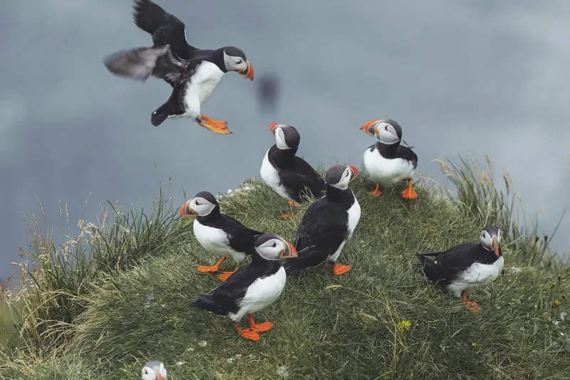
A guided walk from Vík climbs Reynisfjall and follows its top for about 40 minutes to the south-facing cliff, where the Reynisdrangar and the black beach lie directly below. In summer puffins nest along these cliffs. The walk starts behind the information centre in the village, takes children from 6 and groups of up to 17. It is a new listing, so check the details when you book.
Tandem paragliders usually take off from the same mountain and spend 10 to 15 minutes in the air over the coast. On horseback, a three-hour ride crosses rivers and fields to the coastline near Reynisfjara, with about an hour at a viewpoint; riders must be at least 10 and no heavier than 100 kg.
More rides are on our horse riding page, and the flights are compared under kayaking, paragliding and zipline.
Light and weather through the year
You can visit the beach in any month. In midwinter the sun is up for about four and a half hours, from 10:59 to 15:29 on 21 December. In June the sun sets after 23:30 and the night stays bright. Whatever the season, the signs and the light at the access decide how far you may walk. Before you drive, the Safetravel app lets you leave a travel plan and send your position to 112 in an emergency.
All tours side by side
Ways to see the beach and the stacks with a guide: on horseback along the coast, on foot over the top of Reynisfjall, or in the air on a tandem flight.
| Tour | Format | Duration | Age | Rating | From |
|---|---|---|---|---|---|
| Tandem paragliding over VíkTrue AdventureAn instructor pilot flies you for up to 15 minutes, weather permitting; keep about two hours free and call the day before. | Tandem flightFlight of up to 15 minutes | 1 hourTrue Adventure, Vík | From 12 years, 30 to 120 kg | 4.9 (20 reviews) | From €315Free cancellationBook on GetYourGuide |
| Riding to the coast near ReynisfjaraSaddle StoriesThe ride crosses rivers and open fields to the coastline near Reynisfjara; age, weight and riding experience are checked after booking. | Guided rideGuide, Icelandic horse, safety equipment | 3 hours | From 10 years, max. 100 kg | 5.0 (7 reviews) | From €289Free cancellationBook on GetYourGuide |
| Guided walk up ReynisfjallTrue AdventureA guide leads you up Reynisfjall to the south cliff above the Reynisdrangar sea stacks; puffins nest there in summer. | Guided walk | 1 hourTrue Adventure, behind the Vík information centre | Children from 6 | – | From €65Free cancellationBook on Viator |
Prices and ratings come from the booking platform and are shown in euros per person. If you book through these links we earn a commission. Your price stays the same. Sorted by number of reviews.
Questions travellers ask
Is Reynisfjara ever closed?
The beach is not closed as a whole, but it is divided into zones. With a yellow light you must stay out of the yellow zone, and with a red light out of the red zone; since August 2025 the path to the basalt columns and the cave is then closed off at the viewing platform. After erosion in February 2026 the Icelandic Tourist Board said visitors could only go as far as the upper beach ridge, so follow the signs on the day.
Why are the waves at Reynisfjara so dangerous?
Single waves run much higher up the sand than the ones before, without warning. Visit South Iceland warns that they are deceptive and have killed a number of visitors in recent years, even in the best of weather.
Can I go into the cave Hálsanefshellir?
Only when the light allows it. Since the rules were tightened in August 2025, the route to the basalt columns and into the cave is forbidden when the red light is on. In February 2026 erosion made the columns unreachable for a time.
Is there a lifeguard or ranger on the beach?
No. There is no safety staff on site. Police cameras watch the beach, but in an emergency you call 112.
Is Reynisfjara safe for children?
Only with care. Keep children by the hand and on the beach crest above the waterline, and follow the signs at the access. The most recent fatal accident, in August 2025, involved a child.
Where these facts come from
Dates, opening hours and rules change. We checked these pages in October 2026; the official source has the final word.
- Ferðamálastofa: Increased safety and better information with new signs in Reynisfjara (16 December 2022)
- Visit South Iceland: Reynisfjara, Reynisfjall and Reynisdrangar
- Iceland Monitor: Red warning light to activate sooner at Reynisfjara (6 August 2025)
- Ferðamálastofa: Reynisfjara Beach, recent changes due to coastal erosion (24 February 2026)
- Iceland Monitor: Closure gate likely to be installed today (11 August 2025)
- Iceland Monitor: Tourists ignore red warning light at Reynisfjara (25 September 2025)
- Iceland Monitor: Facility fee at Reynisfjara Black Beach (14 July 2023)
- Iceland Monitor: The light was yellow, last three accidents in the same spot (5 August 2025)
- Umhverfisstofnun: Dyrhólaey, access and management
- Safetravel (ICE-SAR)
- US Naval Observatory: Sun data for Vík
- Tour pages on GetYourGuide and Viator, checked 23 October 2026